Feeds:
Posts
Comments

Posts Tagged ‘navajo bridge’

Road Tripping

If all difficulties were known at the outset of a long journey, most of us would never start out at all.” – Dan Rather

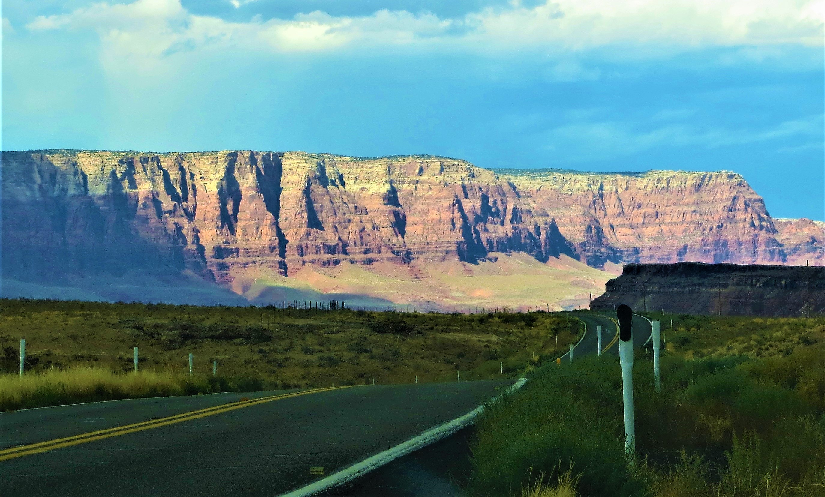
Nothing beats a lonesome scenic backroad for a peaceful drive. This scene is just west of the Navajo Bridge on Highway 89A, — Photo by Pat Bean

The Last 500 Miles

            Day 12: Jean and I were on the road by 7 a.m. After being together almost constantly for 12 days our attitudes were both a bit crusty. We are not anything alike. And with so much time spent in each other’s company, our individual trifling quirks had become major annoyances.

Jacob Lake Campground: Peaceful and soothing.

So it was that the 10-hour scenic drive home was made with little conversation. This was OK for both of us, I think. I enjoy driving in silence, preferring not even to listen to music, and Jean could peacefully enjoy some awesome scenery she had never seen before.

After leaving St. George, we would head to nearby Hurricane, Utah, where we would hook up with Highway 59 that would turn into Highway 389 when we hit the Arizona border near the infamous Colorado City. The town was formerly called Short Creek and had been founded by polygamists when the Mormon Church abandoned the practice.

We didn’t make the turn off to the town, but back in the early ‘70s, I had driven through it – and it had been creepy. My car was followed until it was well past the town limits.

Our drive then took us through the Kaibab Indian Reservation almost all the way into Fredonia, where we would hook up with Highway 89A. This scenic backroad is one of my favorites.

Navaho Bridge

We stopped for a break to walk our dogs, Scamp and Dusty, in Kaibab National Forest’s Jacob Lake Campground located near the turnoff to the North Rim of the Grand Canyon I had stayed here a couple of times during my RV-ing years, and found it pretty much as I remembered  it: Peaceful and uncrowded with the scent from the Ponderosa pines that towered above soothing my soul.

Back on the road, we would cross over the Navaho Bridge that sits high above the Colorado River. I had floated beneath this magnificent 44-foot wide, 447-feet high bridge twice during the first days of my two 16-day rafting trips on the river through the Grand Canyon. I had also driven across the older 18-foot wide bridge before the new one was built. That one is now a footbridge across the river.

This section of today’s drive was filling my brain with vivid memories, and they continued as we passed the Vermillion Cliffs, where the first California condors born in captivity had been released. As a reporter, I wrote several stories on the recovery of this magnificent bird, whose population went from 27 in the 1980s to over 500 today, including 300 that are once again flying free in the wild.

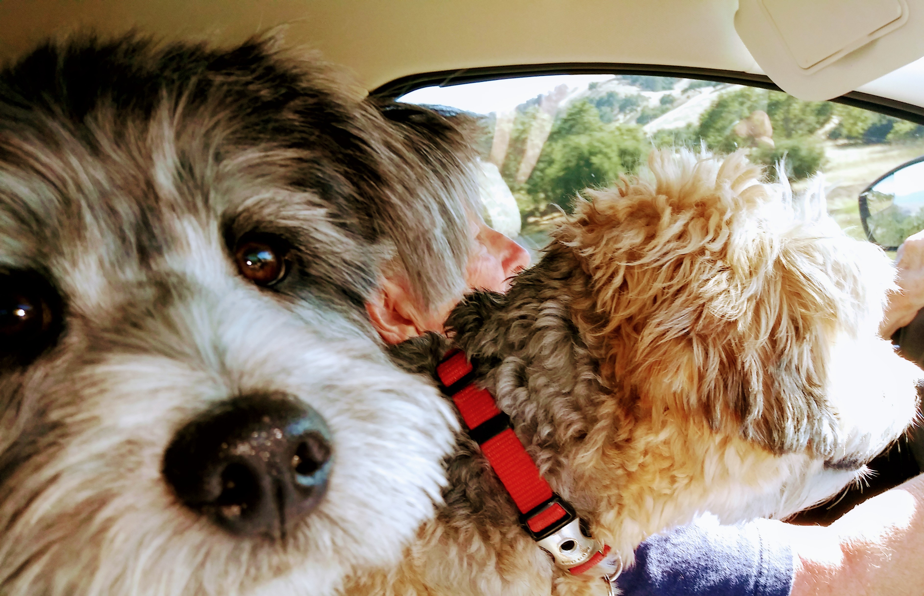
Scamp and Dusty were eager to get home too. — Photo by Jean Gowen

While today’s drive may have been the longest of the trip, it didn’t seem that way. Soon we were on Highway 17, that would take us into Flagstaff, and then into Phoenix, where we picked up heavy traffic again, and finally onto Interstate 10 that took us into Tucson.

There is no place like home.

As for the uncomfortable tension and any unresolved issues between Jean and I, we got over them. About two weeks later, we had a good talk, and our friendship is even stronger now than it was before. This was the trip’s silver lining – the one I’m always trying to find.

Bean Pat: Living Life Graciously https://imissmetoo.me/2019/08/22/your-table-is-ready/ My kind of dining room table.

Pat Bean is a retired journalist who lives in Tucson. She is a wondering-wanderer, avid reader, Lonely Planet Community Pathfinder, Story Circle Network board member, author of Travels with Maggie available on Amazon, enthusiastic birder, and is always searching for life’s silver lining.

Read Full Post »


This is an aerial view of the two Navajo Bridges, with the original one on the left. -- Wikimedia Photo

This is an aerial view of the two Navajo Bridges, with the original one on the left. — Wikimedia Photo

          “No man ever steps in the same river twice, for it’s not the same river and he’s not the same man.” — Heraclitus

Beneath Which Flows the Colorado River


Looking down at the Colorado River from the original Navajo Bridge. -- Photo by Pat Bean

Looking down at the Colorado River from the original Navajo Bridge. — Photo by Pat Bean

           The first time I ever crossed the original Navajo Bridge was in the 1960s, and it was night. Built in 1929, and then the highest bridge in the world with the next bridge crossing the Colorado River 600 miles away, were facts which I knew at the time, and facts that sent a shiver of anticipation down my spine , and a bit of dread because of the dark night.

After that first crossing, I drove over the narrow bridge probably over a dozen times more over the next 30 years, and then I walked across it, and stared across it at the new, wider, stronger Navajo Bridge that was built in 1995. The old bridge was kept for foot traffic, with a parking area and a historical museum at one end, and a parking area and Native American open-air market stalls at the other end.

I’ve never crossed the bridge without stopping, and this morning was no different. Pepper and I walked to the middle of the bridge, where I looked down on the river, this time with camera in hand.

My two rafting trips through the Grand Canyon had started just a few miles upstream at Lee’s Ferry, the only easy crossing of the Colorado River within a hundred miles before the first Navajo Bridge was erected. The site is named after John Doyle Lee, who operated a ferry across the Colorado at this spot for many years.

Looking across at the Colorado River as it flows beneath the new Navajo Bridge. -- Photo by Pat Bean

Looking across at the Colorado River as it flows beneath the new Navajo Bridge. — Photo by Pat Bean

Just a short distance downstream Navajo Bridge crosses the Colorado River at Marble Canyon, which marks the start of the 277-mile long Grand Canyon. This spectacular gorge varies from up to 18 miles wide and 6,000 feet deep. But it’s only a little over 800 feet wide at the Navajo Bridge crossing, and a little less than 500 feet deep.

Looking down on the river from the original bridge this day, I envision myself floating beneath it, and a flood of wonderful memories canter through my brain. Sixteen days, each trip, of river baths, sleeping on sandy beaches, sunbaked skin, watching stars pass overhead through a slim ribbon skylight, hikes to waterfalls and fairy-like hidden canyons, no phones, no mirrors and, most memorable, an unexpected swim through Granite Rapid.

My excuse for taking this road trip was to see aspens in their autumn splendor. I suspect, however, that once again crossing Navajo Bridge was never far from my mind. To be continued …

Blog pick of the Day. Check it out.

Blog pick of the Day. Check it out.

Bean Pat: There was a man http://tinyurl.com/peztncx Poetry and Flowers. Who could ask for anything more? A little bread and wine, maybe?

Read Full Post »

The late afternoon sun bathed the Vermillion Cliffs in a glow that set off their redness. -- Photo by Pat Bean

The late afternoon sun bathed the Vermillion Cliffs in a glow that set off their redness. — Photo by Pat Bean

            “Life should not be a journey to the grave with the intention of arriving safely in a pretty and well preserved body, but rather to skid in broadside, thoroughly used up, totally worn out and loudly proclaiming: Wow! What a ride.” — Hunter Thompson

Colorful Detour

            My canine traveling companion, Pepper, and I took off in my RV, Gypsy Lee, this past week for a 1,700-mile roundtrip from Tucson to Ogden, Utah. It’s the first road trip we’ve taken since I kind of put roots down in the Arizona desert city in January– and then promptly broke my ankle.

Navajo Bridge with the mighty Colorado below -- but not looking so mighty at the moment. But having been eaten by Granite Rapid downstream, I do know it is mighty. -- Photo by Pat Bean

Navajo Bridge with the mighty Colorado below — but not looking so mighty at the moment. But having been eaten by Granite Rapid downstream, I do know it is mighty. — Photo by Pat Bean

Being on the road again feels wonderful. Even Gypsy Lee, who has over 135,000 miles on her, seemed happy to be traveling again.

The plan for one day of travel was to spend the night in Page, Arizona. That plan went awry when I came upon a road block at Highway 89’s junction with Highway 89A. I had driven Highway 89 into Page many times and I suspected a landslide had occurred somewhere along the scenic route.

Later research showed my suspicions exactly right. It had happened in February, but I hadn’t heard the news.

The detour didn’t really add miles to my drive, but did mean that I would spend the night in Kanab, Utah, instead of Page. What made me a little grumpy is that it meant I was traveling Highway 89A, which goes over the high Navajo Bridge, beneath which flows the Colorado River through the Grand Canyon, near Lee’s Ferry.

And this is why I had to detour. -- Arizona Highway Photo

And this is why I had to detour. — Arizona Highway Photo

It was not an unfamiliar route, and even one that I had planned to take on my return trip home so I could double my landscape viewing. Twice, in my younger more fit days, I had floated beneath this bridge at the start of a 225-mile, wild, white-water raft ride through the Grand Canyon.

What I was grumpy about was that I was hitting this stretch of road late in the afternoon and wouldn’t have much time to linger long along the way to gaze in awe at the awesome landscape. I don’t drive after dark.

I did, however, stop briefly at the bridge’s overlook for a view of the magnificent Vermillion Cliffs that lay to my north on the Arizona-Utah border. They were brilliantly bathed in the evening light showing why they had been named.


Read Full Post »