“Often while reading a book one feels that the author would have preferred to paint rather than write, one can sense the pleasure he derives from describing a landscape or a person, as if he were painting what he is saying…” – Pablo Picasso
The Vermillion Cliffs in Northern Arizona is part of the Mongollon Rim. — Photo by Pat Bean
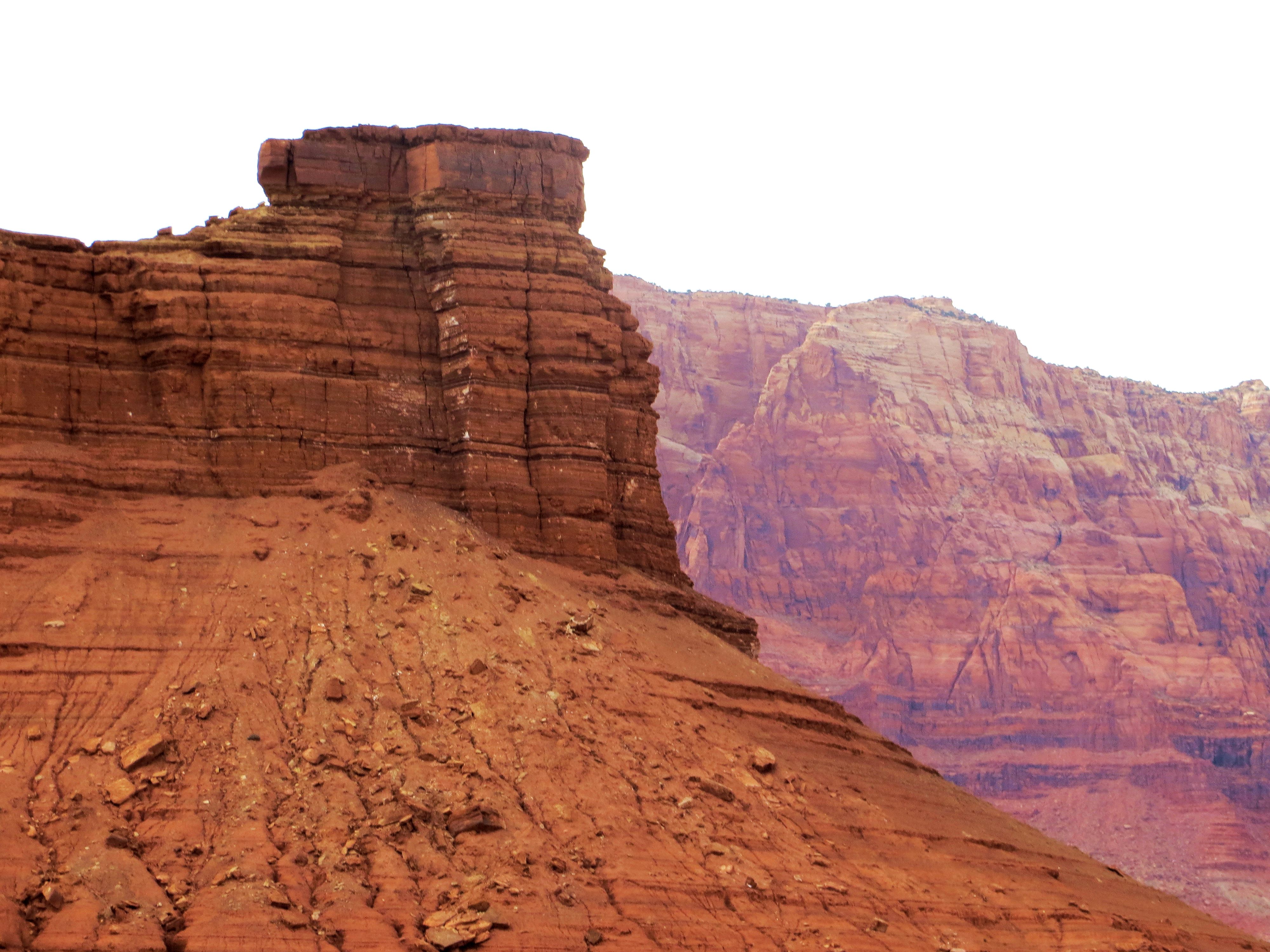
The Mongollom Rim
I don’t quite agree with Picasso’s reasoning. While I do think of painting a landscape when I’m writing, I’m totally satisfied doing it with words. But then finding the right words to let a reader see a specific place never comes easy – at least it doesn’t for me. And reading about a place in a book often never satisfies me.

Oak Creek Canyon, which follows the Mongollom Rim between Flagstaff and Sedona, Arizona. — Photo by Pat Bean
Take this morning, for example. I was reading a chapter in “The Desert Southwest: Four Thousand Years of Life and Art,” and within a few sentences, authors Allan and Carol Hayes, mention the Mongollom Rim, the 38th Parallel (which of course made me think of the Korean conflict dividing line) and the Tropic of Cancer.
Now while all three terms were familiar to me, I didn’t know exactly how their locations were being used in reference to the American Southwest. Having a mind that must be satisfied, I did a bit of research.
First I found a map that followed the 38th Parallel around the world, and learned that it bisected the United States north of San Francisco, south of St. Louis and south of Washington D.C.
Next I refreshed my memory on the Tropic of Cancer, which bisects Mexico south of the U.S. border, and relearned that it is the circle of latitude on Earth that marks the most northerly position at which the Sun may appear directly overhead at its zenith. This imaginary line is called the Tropic of Cancer because when the Sun reaches the zenith at this latitude, it is entering the tropical sign of Cancer.
So from this, I knew the area referred to in the book was located south of San Francisco and north of Baja California Sur.
I knew more about the Mongollom Rim because of my travels across this country, and knew I had crossed it quite a few times, but didn’t remember exactly where. The rim is the edge of the Colorado Plateau, and often the dividing line between landscapes below 5,000 feet and above 8,000 feet. Pin-pointing the rim on a map, I realized I had recently followed along it when I drove from Phoenix to Flagstaff on Highway 17.
And now you know what my wondering-wandering brain was up to this morning.

Blog pick of the day.
Bean Pat: Losing Leroy http://tinyurl.com/pteym6y I once met Leroy. And this blog brought tears to my eyes – but joy, too. My mother


Thank you ever so for the Bean Pat–particularly since you actually met Leroy.
You’re welcome
Again, I like the way your mind works!
And your photos are GORGEOUS!!
Thanks Alex