Feeds:
Posts
Comments

Posts Tagged ‘Alaskan Highway’

“Though we travel the world over to find the beautiful, we must carry it with us or we find it not.” — Ralph Waldo Emerson

The Sign Post Forest at Watson Lake alongside the Alaskan Highway. -- Wikimedia photo

The Sign Post Forest at Watson Lake alongside the Alaskan Highway. — Wikimedia photo

2001 Memories of a Non-Wandering Wanderer

          It was going to be a long day’s drive, and so I was on the road at 5 a.m., sharing it with a pumpkin orange and lavender sunrise that breathed joy into my pores.

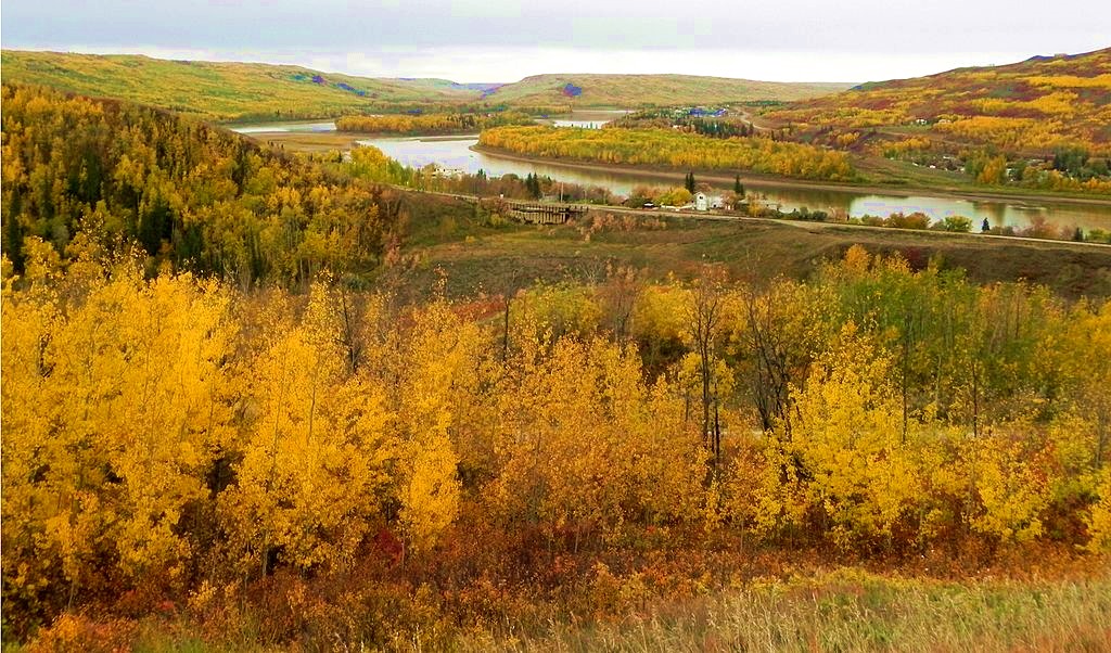
My drive took me past Muncho Lake Provincial Park. The lake, which I followed for a bit, was just one of several clean, clear blue bodies of water along the way. The biggest one was Teslin Lake, which I noted in my journal, had an average depth of 184 feet.

At Liard Hot Springs, at Mile Marker 496, I stopped for a short hike to the springs and the marsh’s hanging gardens, which consisted of a jumble of rocks with plants hanging down the sides while a series of small falls trickled past. The place had a pungent, sulphur odor that tickled my sense of smell, and encouraged me not to linger overly long..

Alpha Pool in Liard River Hot Springs along the Alaskan Highway in British Columbia. -- Wikimedia photo

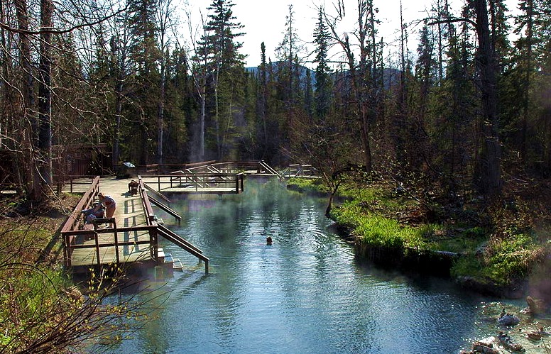
Alpha Pool in Liard River Hot Springs along the Alaskan Highway in British Columbia. — Wikimedia photo

At Watson Lake, Mile Marker 635, I refueled and gawked at the famous Sign Post Forest, which now has about 100,000 signs. “Sort of icky,” I wrote in my journal, noting that nature got my juices flowing better.

The fake forest began in 1942 when Pvt. Carl Lindley was ordered to repair a simple sign post noting the distances to various points along the road when it was being built. He personalized the sign by adding his home town of Danville, Illinois, 2,835 miles away.

Meanwhile, the warning signs of moose and caribou on the road, which had been lying to me,:told the truth this day. I saw several of each, plus deer, too, as my winding drive took me across the British Columbia-Yukon border seven times.

After a long day’s drive of nearly 600 miles, with several sightseeing stops along the way, it was almost 10 p.m., but still light, when I finally pulled into Whitehorse, where my room at the High Country Inn had been upgraded. I had my own Jacuzzi, and I took advantage of it.

Blog pick of the Day. Check it out.

Blog pick of the Day. Check it out.

Bean Pat: Two Photographs: http://tinyurl.com/hylkuth Unusual shots of a peregrine falcon, one of my favorite birds. I usually saw them when they flew below me on my hike up to the top of Angel’s Landing in Zion National Park. This is a bird we humans have helped save from extinction.

Read Full Post »

“Perhaps travel cannot prevent bigotry, but by demonstrating that all peoples cry, laugh, eat, worry, and die, it can introduce the idea that if we try and understand each other, we may even become friends. “– Maya Angelou

An autumn scene along the Peace River, not exactly the view I saw during my trip but I certainly saw river-side landscapes that were just as awesome. -- Wikimedia photo

An autumn scene along the Peace River, not exactly the view I saw during my trip but I certainly saw river-side landscapes that were just as awesome. — Wikimedia photo

2001 Memories of a Non-Wandering Wanderer

          I compared my first day of driving the Alaska Highway through Canada to a day of riding steep roller coasters. The route crossed many creeks and rivers, and most of the driving was done in the rain.

A page from my 2001 Alaska Trip journal.

A page from my 2001 Alaska Trip journal.

My guide for the Alaska Highway was the 2001, 53rd edition of The Milepost, which listed all the sights of the route in milepost numbers. As much as my interests, and time, demanded, I took short detours to see them, including one off road adventure to find Peace River Park, supposedly on an island across a causeway. I noted in my journal that the causeway was dinky.

The only animals I saw this day were brilliant blue Steller jays (visit my September 24 blog for a picture of a Steller jay) at a dump, lots of ravens, one llama, two hawks I couldn’t identify, and one deer. Signs along the way frequently claimed “moose and caribou on road” – but they lied.

I ended the day in Fort Nelson at Mile 300. The small town was named in honor of British naval hero, Horatio Nelson. It was established by The Northwest Trading Company in 1805 to accommodate fur traders. Because of fires, floods, and feuds, according to one history source, Fort Nelson is currently situated in its fifth location.

While in town, I visited the Fort Nelson Heritage Museum, an interesting step back in time that included exhibits of a “Hardly Davidson” scooter, and the first curling stones on the Alaskan Highway.

Blog pick of the Day. Check it out.

Blog pick of the Day. Check it out.

Bean Pat: A funny comics blog http://tinyurl.com/jy9sqhn This is so me!

Read Full Post »

I didn't capture the rainbow in Jasper National Park, but I did manage to get one on another road trip when I visited South Dakota. -- Photo by Pat Bean

I didn’t capture the rainbow in Jasper National Park, but I did manage to get one on another road trip when I visited South Dakota. — Photo by Pat Bean

2001 Memories of a Non-Wandering Wanderer

I left Jasper at sunrise, and with a magnificent rainbow welcoming in the day. The first part of the drive took me through Jasper National Park, the largest national park in the Canadian Rockies. Elk, longhorn sheep, deer and Stone Mountain sheep (which I hope stayed in the park because these cousins of Dall sheep are popular with trophy hunters made themselves visible on the road between Jasper, Grand Cache and Grand Prairie.

Alberta’s Grand Prairie, aptly named and then nicknamed the Swan City, adopted the trumpeter swan as its symbol because of its proximity to the bird’s migration route and its summer nesting grounds. The trumpeter is North America’s largest water bird. It can weigh up to 25 pounds, almost double the weight of the tundra swan that was a familiar sight in Northern Utah where I lived back then.

Of course I hoped to see a trumpeter this day. But I didn’t. Drat it!

Dawson Creek and the Mile 0 Post that represents the start of the Alaskan Highway. -- Wikimedia photo

Dawson Creek and the Mile 0 Post that represents the start of the Alaskan Highway. — Wikimedia photo

I made it to Dawson Creek in time for lunch, even though it was a 325-mile drive from Jasper. Three hundred miles was usually the goal I set for myself most of the days on the month-long adventure.

Dawson Creek, named after the creek that runs through it, which was named after George Mercer Dawson, a member of his land survey team that passed through the area in 1879. The small town’s primary claim to fame is that it is where the Alaskan Highway begins. The town’s population was larger when the highway was being constructed during World War II. The highway, at first unpaved and with almost too many bridges to count, was built to connect the United States with its Alaskan Territory through Canada. Alaska didn’t become a state until 1959.

When completed in 1942, the highway was 1,700 miles long. Today it’s about 300 miles less because of constant straightening and restoration work. When I drove the highway in 2001, it was said to be paved the entire distance – Not true, I discovered.

Bean Pat: This one is for writers who receive rejections: https://millieschmidt.wordpress.com/2016/11/16/ And isn’t that all of us?

Read Full Post »