Feeds:
Posts
Comments

Archive for the ‘Journeys’ Category

You must live in the present, launch yourself on every wave, find your eternity in each moment.” – Henry David Thoreau

Launching myself out of an airplane was a scary moment -- but I smiled all the way down. -- Photo by NikNak

I’ve always thought the advice to do something that scares you at least once a year was good advice. Besides the jolt of adrenalin it gives your brain, it helps in gaining a true appreciation for life.

Following that advice wasn’t hard to do when white-water rafting was my passion. But with age, that activity drifted away with the currents. I found that canoeing was more in tune with my body.

When I turned 70, I got my annual  jolt of adrenalin by jumping out of an airplane, which I thought perfectly fit this week’s photo challenge.

But I now I face another challenge. What can this wandering/wondering old broad do this year to scare herself. I’m open to suggestions.

Read Full Post »

 “My favorite weather is bird-chirping weather.” Terri Guillemets

Himalayan snowcock -- Wikipedia photo

Chasing Birds

While the recently released movie, “The Big Year,” hasn’t been a top box-office hit, I thought it was a great film. Of course I’m a passionate birder and could relate to the chase to be best North American Birder of the Year.

The record number of species seen between Jan. 1 and Dec. 31, by the way, is 745 species. I won’t tell you who holds the title, however, because that might spoil the movie for one of my readers who hasn’t yet seen it.

One of the scenes in the film, which shows just how crazy we birders can get, depicts a wild helicopter chase of Himalayan snowcocks in Nevada’s Ruby Mountains.

Chukar on Antelope Island ... Photo by Pat Bean

Boy I wish I had such a conveyance at my convenience. I’ve never seen this pheasant species, and these days am not up to the rough hike, which unless one is extra lucky, is the most likely way of spotting one.

I may still give it a try next year, however. Like a lot of other birders, “The Big Year” inspired me to step up my birding game. And my curiosity about snowcocks inspired me to see what I could find out about these birds. The Internet, which I have come to love, turned up a couple of interesting blogs from birders who have seen the Himalayan snowcocks in the Ruby Mountains.

I noticed, when looking at pictures of the birds on a couple of Web sites – http://tinyurl.com/3uya55p and http://tinyurl.com/3w6edbx– that the snowcocks look a lot like the chukars I have seen on Antelope Island in Utah’s Great Salt Lake.

The chukar, however, is not a difficult bird to add to one’s life list. It can be seen in at least nine western states, whereas the snowcock can only be found on this continent in the Ruby Mountains. And it wouldn’t even be there except that Nevada Fish and Game thought the bird would be a good game bird for hunters – and in the 1960s, transplanted about 200 of them there from Pakistan.

There may be 500 or more of the birds today roaming around the mountains near Wells, Nevada. Yes, I am for sure going to have to visit the Ruby Mountains soon. The snowcocks are calling to me.


Read Full Post »

 “Do not go where the path may lead, go instead where there is no path and leave a trail.” Ralph Waldo Emerson

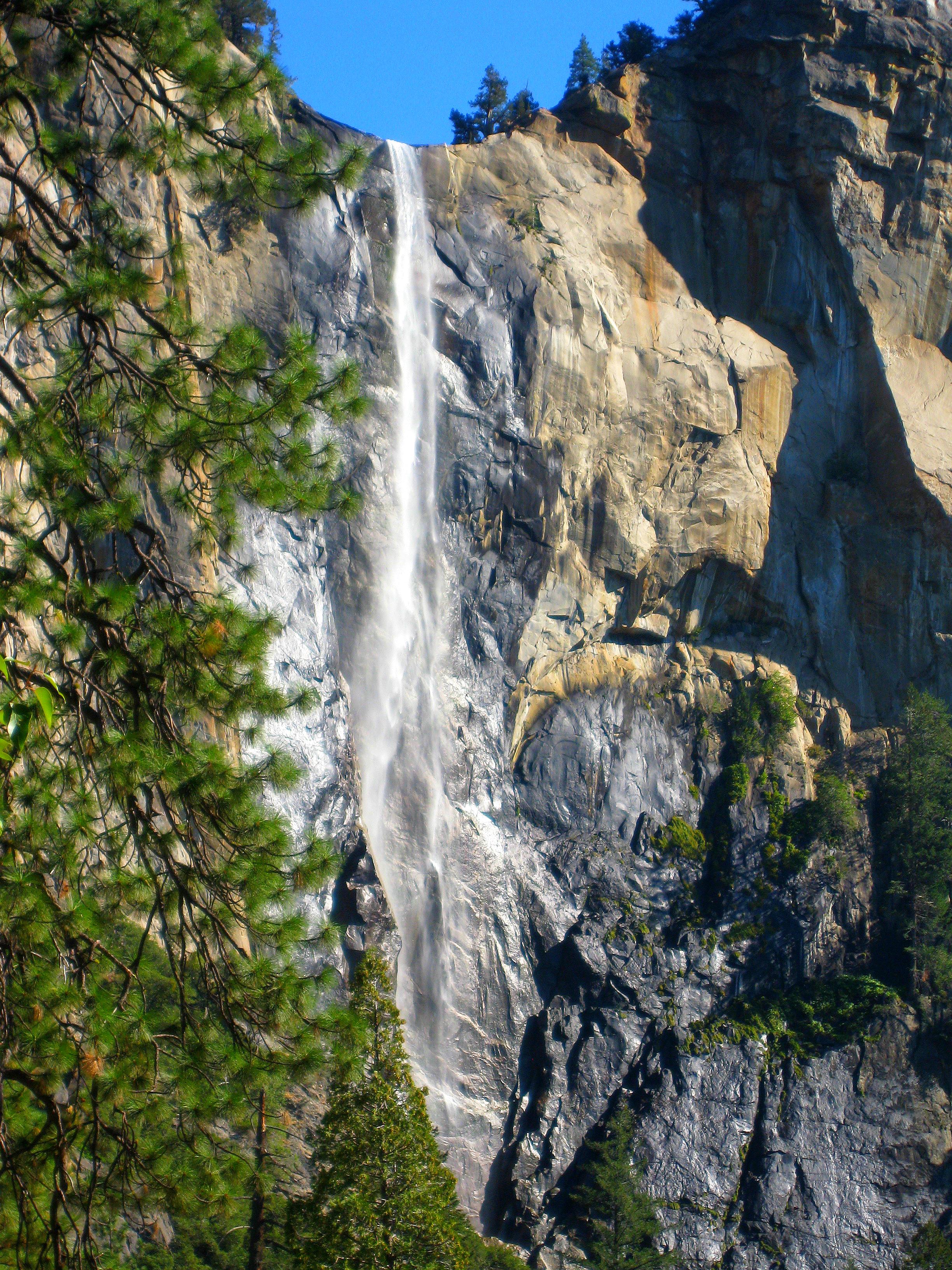
Walking beside a quiet stream and taking pictures of it, especially when the water is full of reflections, is one of my favorite things to do. This stream is located along Highway 41 in Yosemite National Park. -- Photo by Pat Bean


Travels With Maggie

I recently came across a great travel blog called Wanderings. It’s written by Shannon and Brian, who like me unloaded possessions and took off in an RV to see the country.

I particularly enjoyed one of their recent posts: “7 Lessons from a Year on the Road,”  http://wanderings2010.wordpress.com/

In it, they noted that the “path is beaten for a reason.”How true I thought, but then remembered how much planning I do to take the road less traveled when I have a choice. Or do I?

I hadn't noticed the waterfall before i stopped beside the stream. What a nice surprise. -- Photo by Pat Bean Since beginning my travels with my canine companion, Maggie, seven years ago I’ve seen many of this country’s most popular tourist sites, including Niagara Falls, Mount Rushmore, St. Louis’ Gateway Arch, The Golden Gate Bridge, the Everglades, and numerous national parks, including my visit just this past month to Yosemite.

My solution to finding a little peace at some of the more popular tourist sites has been to visit them after Labor Day and before Memorial Day. This strategy has at least minimized the impact of traffic jams around the more popular attractions.

I’ve also discovered that even in the midst of hundreds of tourists, it’s still possible to find a bit of solitude to ease the pain of jostled elbows, the cacophony of noise and long lines.

I found it in Yosemite when I pulled off the road at a convenient spot to take some pictures of a small stream and stretch mine and Maggie’s legs a bit. There was room for only two other vehicles to park at the spot, which had no markers and wasn’t indicated on the park’s map.

Except for one lone fisherman, who was upstream a ways, Maggie and I had the place to ourselves. After taking a few pictures of the stream, I glanced up at the rock cliffs on the far side of the water.

Wow! I thought when I saw the waterfall. I had chosen well for my off-the-beaten path rejuvenation stop.

I guess it doesn’t matter which path you choose to follow – beaten or unbeaten – as long as you take one of them.


Read Full Post »

“…we turned a point of the hill on our left, and came suddenly in sight of another and much larger lake, which, along its eastern shore, was closely bordered by the high black ridge which walled it in by a precipitous face … Spread out over a length of 20 miles, the lake, when we first came in view, presented a handsome sheet of water; and I gave to it the name Lake Albert, in honor of the chief of the corps to which I belong. …” John Fremont

Lake Albert's southeast end from Highway 395. -- Photo by Pat Bean

Travels With Maggie

Highway 395 stretches for 1,370 miles – from the Canadian border in Washington, down through Oregon, California, Nevada and back into California, where it ends just about 150 miles short of the Mexican border. .

I drove 730 miles of it heading south last month, beginning in Pendleton, Oregon, and ending when I turned west onto Highway 120 that would take me up and over 9,943-foot Tioga Pass through the Sierra Nevada Mountains and down into Yosemite Valley.

Much of the drive was on steep, narrow, winding roads with little traffic. I loved every moment of the journey.

Lake Albert from Albert Rim -- Wikipedia photo

The route winds through Oregon’s Battle Mountain State Park, the Umatilla, Malheur, Modoc, Toiyabe and Inyo national forests, and the X L Ranch Indian Reservation, passing numerous lakes on the way. There’s Goose Lake in Oregon, located near Fandango Pass that was used by early settlers to California; Nevada’s Washoe Lake, located between Reno and Carson City and popular with windsurfers; and Mono Lake in California, which was on my bucket list because of its importance to migrating shore birds.

A smaller lake that captured my attention was Oregon’s Lake Albert. Like Mono, it is too salty for fish to live in its waters. It has, however, a dense population of brine shrimp that make it a popular dining stopover for migrating grebes, phalaropes, terns, avocets, geese, stilts, ibis and other birds.

Albert Rim geology marker -- Photo by Pat Bean

Canada geese were the main occupants on the narrow lake the day I drove the 15-mile section of Highway 395 that overlooks the east side of the lake from just feet away. I stopped several times to admire the lonely and lovely view of pink hills reflecting onto the water from the opposite shore.

I also found myself fascinated by the geology marker that explained the lava ridge running parallel to the lake. Known as the Albert Rim, it’s one of the highest fault scarps in the United States.

Except for the highway, which ran between the basalt ridge and the lake, and an occasional passing vehicle, I suspected the landscape still looked pretty much as it did during John Fremont’s mapping expedition in central and southern Oregon back in the 1840s.

It’s rare to find a place so little impacted by we humans – and wonderful.

Read Full Post »

“True love stories never have endings.” – Richard Bach

I'm not sure who took this picture of my grandson popping the question, but my thanks to them for capturing a picture that's worth more than a thousand words. I couldn't resist writing about the wedding simply so I could post this photo.

A Day to Remember

I watched my third oldest grandchild get married yesterday evening.

As it should be, the bride, Sheila, was beautiful and the groom, David, was shaking in his new suit.

The “girls” had a breakfast earlier in the day, and the “boys” a lunch. At the breakfast, Sheila was worried, as are all brides, about what could go wrong. I told her that at least one thing SHOULD go wrong to make the wedding memorable.

The ceremony, however, went off without a hitch. Too bad, I was thinking.

But then, when it came time to take the photos, someone remembered the boutonnieres for the men’s lapels and the corsages for the women’s dresses that had been forgotten.

“See.” I told Sheila.  “Your wedding turned out perfect after all.”

Read Full Post »

 “A journey is a person in itself; no two are alike. And all plans, safeguards, policing, and coercion are fruitless. We find that after years of struggle that we do not take a trip; a trip takes us.” – John Steinbeck

My wandering mind waa on green jays as i drove Highway 36 toward Lake Jackson. -- Photo by Pat Bean

Travels With Maggie

With my canine traveling companion, Maggie, snoozing away in her co-pilot seat, I left Harker Heights, and my oldest son’s home, early for our drive to Lake Jackson, and my middle son’s home 250 miles away. It’s a very familiar drive for me, one I’ve made many times.

As I passed oil rigs, grazing cattle, cotton fields, mesquite trees and roadside sunflowers that let me know I was in Texas, I was glad to see the color green still existed. It had been missing on my drive two days earlier down Highway 190, clear evidence of the dastardly drought the state has been suffering. .

To all Texans living where heat and drought has scorched the landscape, I just wanted to show that green does still exist. This is the view from my RV window in Lake Jackson. -- Photo by Pat Bean

While admittedly things weren’t quite as lush as I remembered from past drives down Highway 36, the landscape was still a far cry from the brown and dying cedar trees, lack of grass and stunted and yellow cactus that had dominated my entry back into the Lone Star state on Tuesday.

The driving this day was easy with little traffic. As usual under such circumstances, my mind begins to wander. This day, it went south to the Rio Grande Valley, perhaps because I was thinking about when I would be able to go there and do some winter birding.

From Lake Jackson, where I was headed, it’s only a half day’s drive. I would have to see what bird festivals were going on down there in the coming months, I thought as I drove.

My mind must have still been with the fantastic green jays down there when I came to the Highway 35 turnoff, because I took it. I was looking for it in fact.

Oops!

I then realized that what I had actually been looking for was the Highway 36 turnoff that I always took when I returned from the valley. But then I had already been on Highway 36.
I guess I should have been paying more attention to where I was than where I wanted to go.

Anybody else out there have a mind that plays tricks on them like that?

If so, I hope you have a traveling companion like Maggie. She never yells at me when I take a wrong turn.

Read Full Post »

 “I advise you to say your dream is possible and then overcome all inconveniences, ignore all the hassles and take a running leap through the hoop, even if it is in flames.” Les Brown

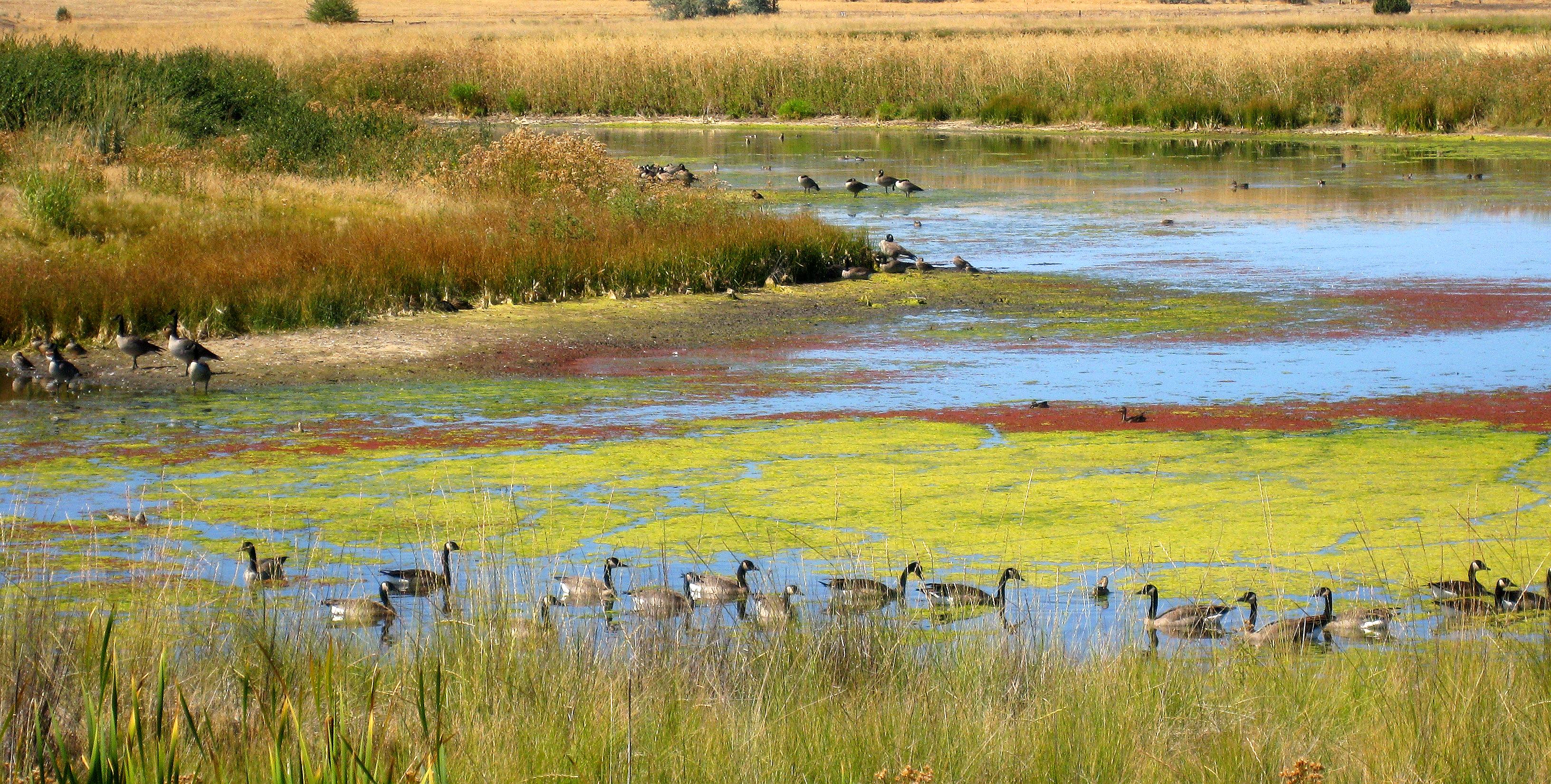
Highway 395 passes through Modoc National Wildlife Refuge, where I stopped a bit to enjoy these Canada Geese. -- Photo by Pat Bean


Travels With Maggie

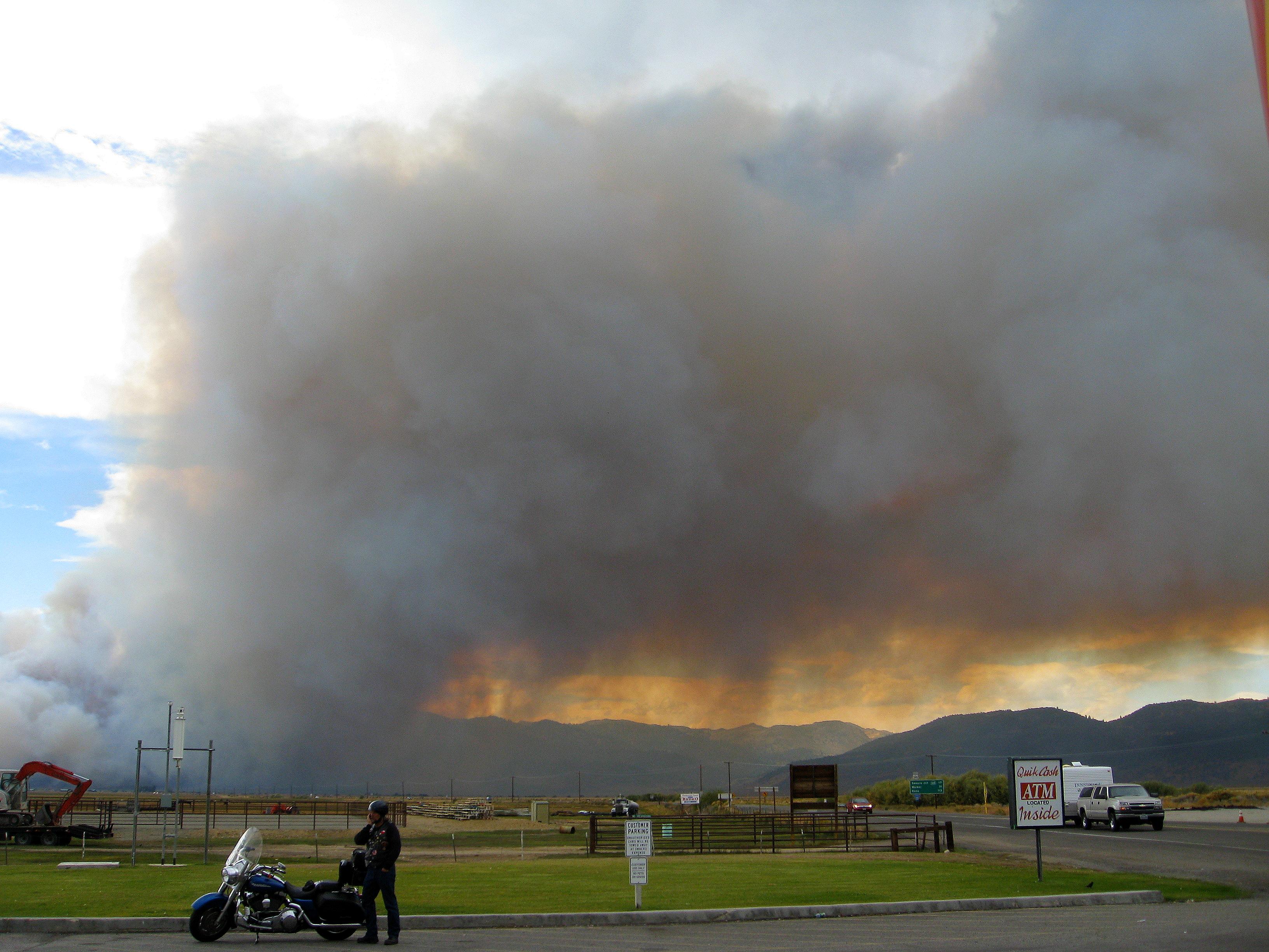
Looking back at the fire from a service station in Bridgeport, where I -- gulp -- paid $4.99 for a gallon of gas. -- Photo by Pat Bean

My travels down Highway 395 the past five days have taken me from Oregon to California to Nevada and back again yesterday into California. \

“I already relinquished my lone apple to the agriculture inspector at the Alturas station,” I said to a second ag inspector as I re-entered California at Topaz Lake yesterday.

She smiled and waved me on.

Highway 395 is not one that will put you to sleep. The landscape it runs through is an eclectic mix of mountain passes, high deserts, green forests, both fresh water and salt lakes, historical parks and national wildlife refugees.

My dog, Maggie, and I have enjoyed every minute of the often steep and twisting drive. Me because of the awesome scenery, and Maggie because driving always lulls her into a pleasant sleep. She also enjoys the scents her nose discovers during our morning and evening walks at a strange new place. .

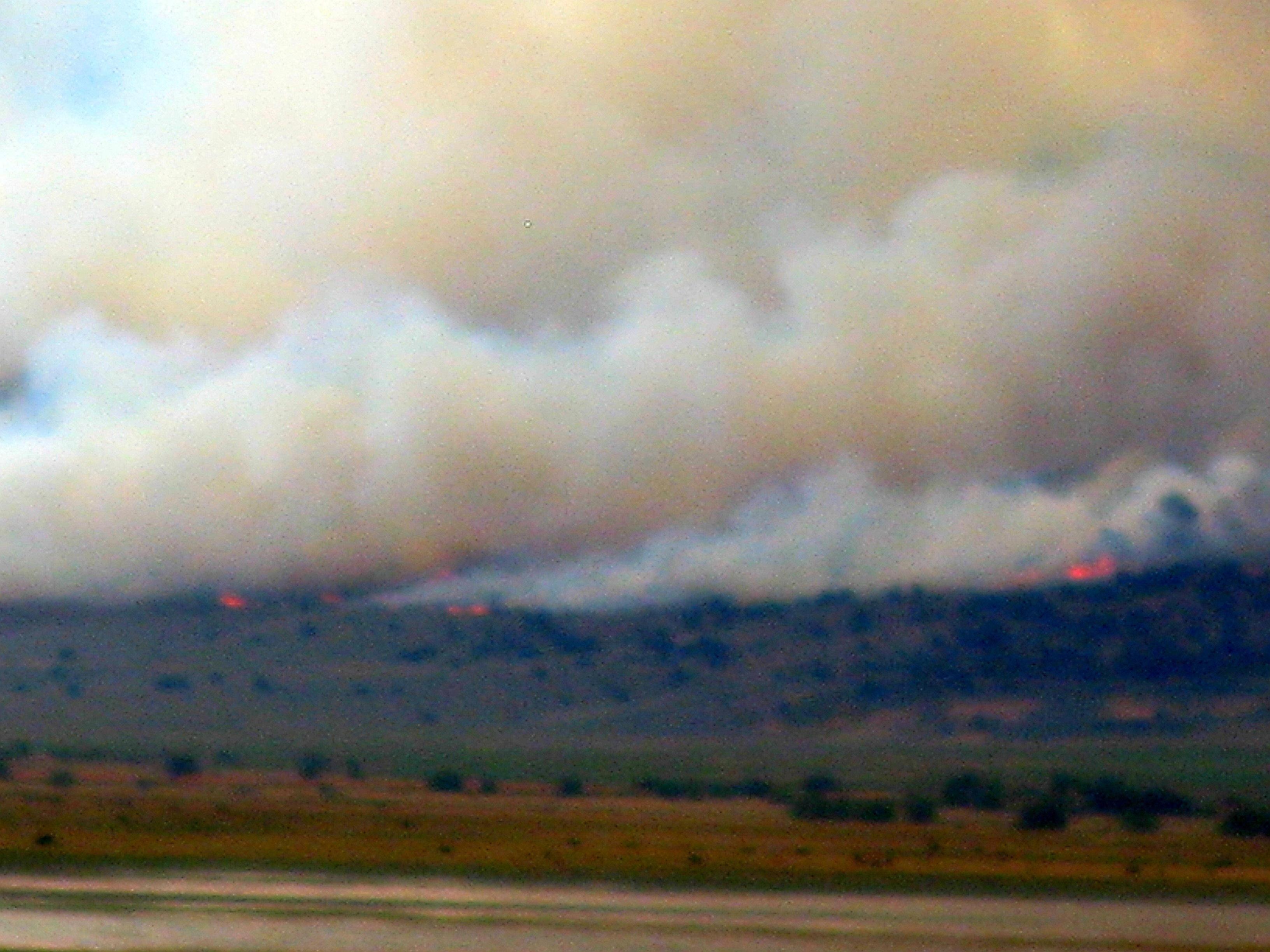
Flames were visible across the water from out Bridgeport Reservoir campground. -- Photo by Pat Bean

Yesterday’s travels took us over 7,000-foot passes that looked up at mountains still containing patches of snow. With all the heat so much of the country has had this year, the sight seemed like a miracle.

The red clouds I came upon in the late afternoon seemed much the same, until I realized the color was being reflected onto them by flames. Suddenly my view ahead was full of smoke, with actual flames occasionally visible from behind a ridge to my right. The flames, however, hadn’t yet reached the road and the smoke was mostly overhead, so I drove on, passing the fire just before entering the town of Bridgeport.

I breathed a sign of relief that the road hadn’t been closed, although I think it was later shut down.

The wildfire is still burning this morning, I can see it from the Bridgeport Reservoir RV Park and Marina, where Maggie and I spent the night.

It was nice, as we slept, to know there was a body of water between it and us.

Read Full Post »

 “The road of life twists and turns and no two directions are ever the same. Yet our lessons come from the journey, not the destination. – Don Williams.
 

The yellow winding road warning sign was no joke. -- Photo by Pat Bean

Travels With Maggie

For two days now, I’ve been traveling south on Highway 395 in Oregon. It’s an awesome road, full of twisty turns, steep canyons, grazing cattle, grassy meadows and flowing water.

I began my journey in Pendleton, where cowboys and Indians still roam, and on the first day I made it to the beautiful Clyde Holliday Park just outside John Day, where quail and deer still play. The second day found me in Lakeview, south of Lake Albert and just north of the California border..

The town of John Day is named for the John Day River, which was named for a Virginian who accompanied the Astor Expedition that followed the footsteps made by the earlier Lewis and Clark Expedition. Clyde Holliday is a successful logging entrepreneur in the area.
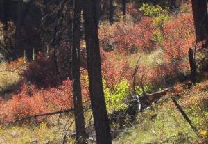
 

The roadsides occasionally hinted of autumn ahead. -- Photo by Pat Bean

The first day on the road took me through Battle Mountain State Park, and gave me a history lesson about the Bannock War. The park is the site of the last major fight the Bannock Indians fought against the encroachment of white settlers.

The highway north of John Day, while steep and winding, was mostly broad and open. The canyon south of John Day was steeper and narrower and often lined with trees. Except for an occasional logging truck, I was usually the only vehicle on the road.

Forks of the John Day River followed me both days. As I drove yesterday I composed a poem in my head. I seldom write poetry, but when I do, I call it soul words, which is my way of excusing my murder of poetic forms.

I hope you will, too.

Time Well Spent

Take me up to the mountain top

Up where the eagle and red-tailed hawk soar

Let me look out on a panoramic vista

Of meadows filled with golden grasses,

And clumps of frosty sagebrush

And patches of yellow wild blossoms

And here and there a tinge of red

That speaks of summer’s end.

Let me delight watching conifer leaves twinkle in the wind

And be amazed at how the stalky evergreens

March their way in jumbled rows up rocky cliffs

Let me linger a bit here on the high reach

Breathing in the fresh sky-scrubbed air

Scented with pungent sage and pine needles

Then let me slowly travel down canyon

Accompanied by the tinkling laughter of water

As it joyfully bubbles over riverbed rocks

Heeding the unwavering  call of gravity

Thankfully my life has seen such days as this

Unfettered by the world’s chaotic-ness

And doubly thankful again this precious day

That I’ve added yet another few peaceful hours 

To my piggy bank of memories.

– Pat Bean

Read Full Post »

 “In this world of change, nothing which comes stays, and nothing which goes is lost.” Anne Sophie

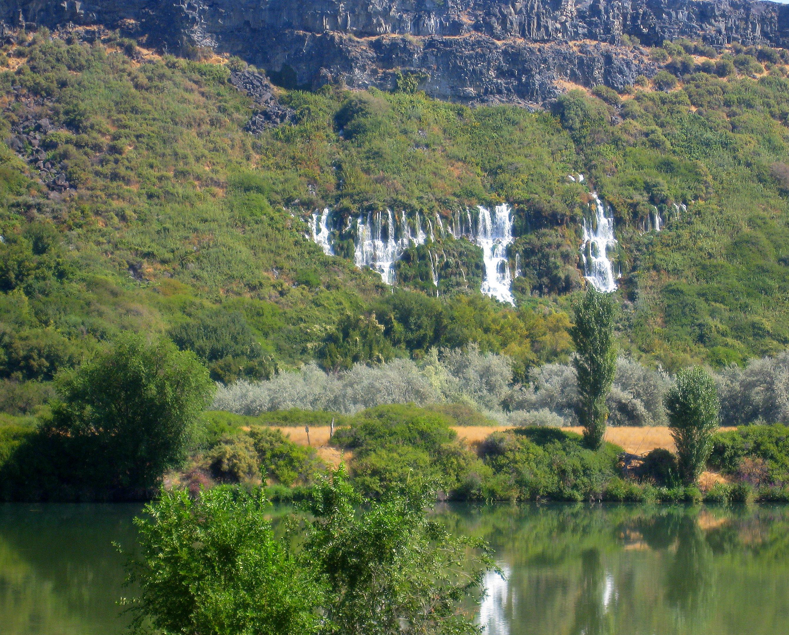
Thousand Springs from the wrong side of the Snake River. -- Photo by Pat Bean

Travels With Maggie

I never exactly got lost yesterday, but I never got exactly where I was going. My maps didn’t help, and my 25-year-old memories were useless.

I wanted to drive the section of Highway 30, known as the Thousand Springs Byway that runs south of Interstate 84 and west of Twin Falls – and I did. But I still never got to the actual site I was trying to find.

Back in the mid-1980s, when I was regional editor at the Times-News in Twin Falls, one of my girl friends took me right up to those rivulets of crystal clear water that gush out of the sides of the steep cliff and flow into the snake river.

I climbed among the tumbled rocks between the rivulets of water, and walked a short boardwalk that had water flowing beneath it. That was the place I wanted to visit again.

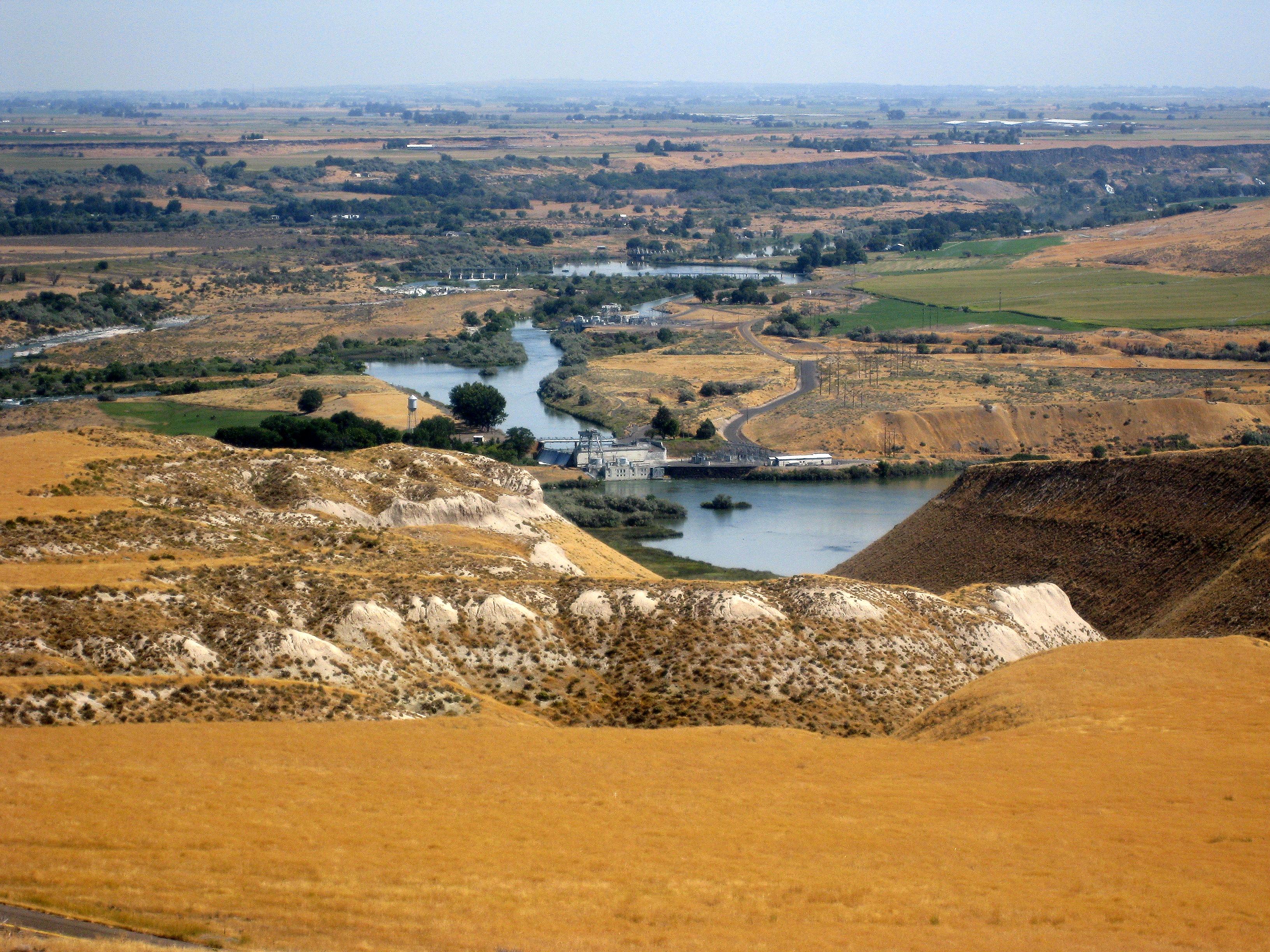
Instead, I found myself on the opposite of the river with only distant views of the springs. And after spending so much time at the nearby Haggarman Fossil Beds, which I was seeing for the first time and told you about in yesterday’s blog, I was short of time to search more.

So instead of close-up views of the springs, all I got was a distant view from the wrong side of the Snake River. And so that’s all you get to see, too.

Read Full Post »

 “Travel and change of place impart new vigor to the mind.” Seneca

Looking down on the Snake River on a landscape over which wild horses roamed 3.5 million years ago, and one settlers crossed going West just 150 years ago. -- Photo by Pat Bean

Travels With Maggie

Did you know Idaho has a state fossil? I didn’t – until today when I visited Haggarrman Fossil Beds National Monument.

It’s the Haggarman horse, which lived about 3.5 million years ago. Fossils from about 30 of the animals, which sort of looks like a hybrid between a horse and a zebra, were found near Haggarman, Idaho, back in the late 1920s.

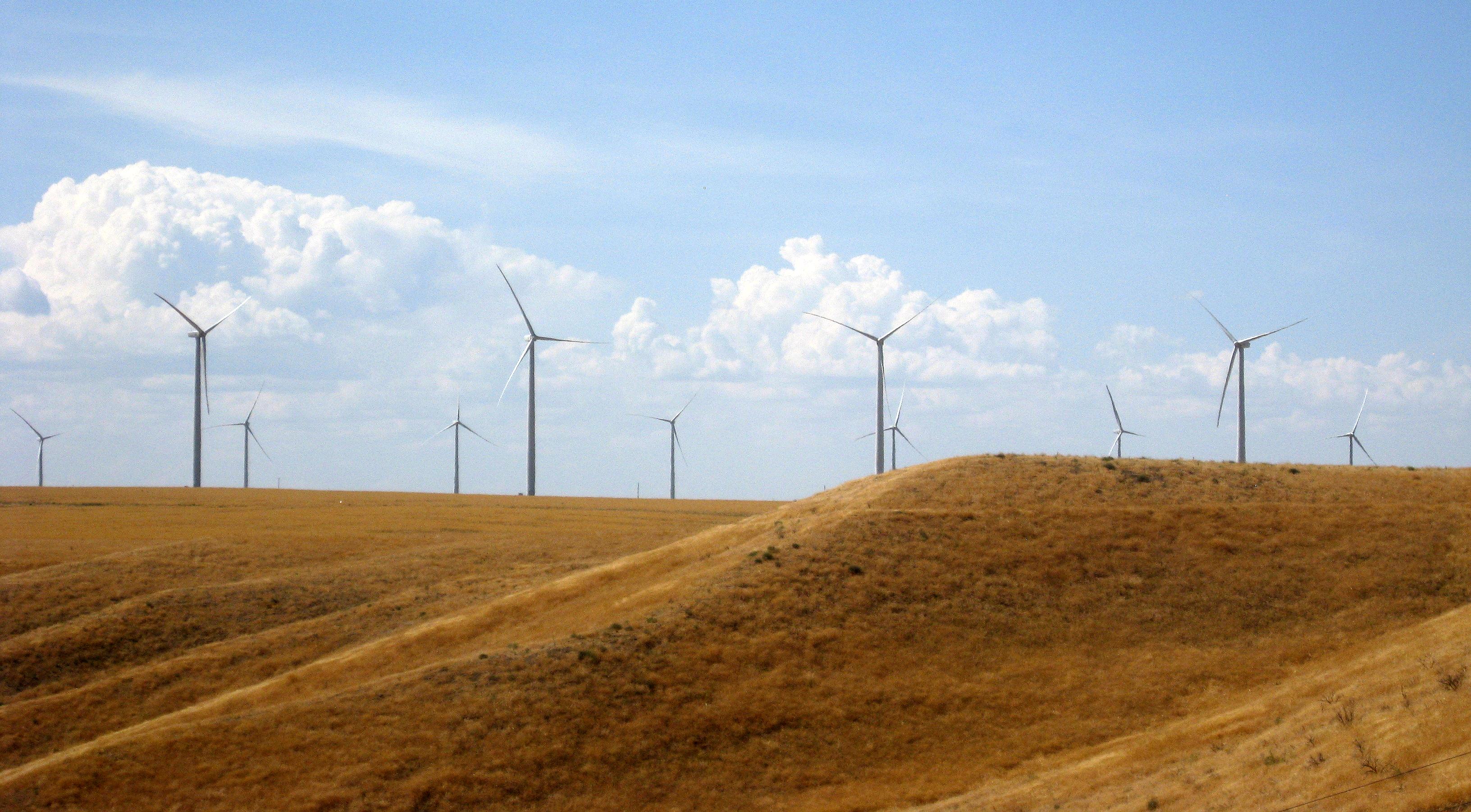
Turning my back on the Snake River, this upward view of the monument looks to the future, and hopefully less dependency on fossil fuels. It's a beautiful view. -- Photo by Pat Bean

The area, which overlooks the Snake River near Haggarman and is about 20 miles north of Twin Falls, has also turned up an extinct species of camel that once roamed North America, as well as a mastodon, a dirk tooth cat and a bone crushing dog that lived over 3 million years ago.

The area is considered a world treasure because it contains the richest known deposits from the Pliocene epoch, the period before the ice age and the same period as the early evolution of man.

Fascinating, or so it was to me.

But the monument also has something for those who only want to go back in time about 200 years. It includes a portion of the Oregon Trail, which was first used by fur trappers, and then in the 1840s for the great western migration.

Today’s first day back on the road was short in miles, but certainly covered a lot of time. Life is good.

Read Full Post »

« Newer Posts - Older Posts »